
Entry & progression
Course: generic Electronic Chart Display and Information System training to IMO Model Course 1.27, required for deck officers on ECDIS-fitted vessels. Type-specific familiarisation on the actual equipment is additionally required. Entry: deck officer or trainee. Related to the deck CoC pathway, where ECDIS is a required ancillary.
The system
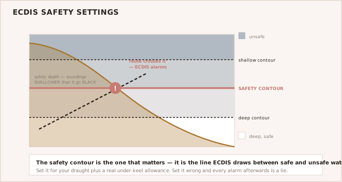
An Electronic Chart Display and Information System displays official electronic navigational charts (ENCs) with the ship's position from GNSS, and integrates radar, AIS and the ship's sensors. Used as the primary means of navigation it must display official, up-to-date ENCs, and it must be set up correctly, because the safety contour, the safety depth and the alarms the officer sets are what determine what the system will and will not warn about. ENCs are official vector charts to the IHO S-57 and S-52 standards, distinct from unofficial raster or vector charts.
Setting ECDIS up for a passage
- Confirm official ENCs for the whole route are installed and updated to the latest edition.
- Set the safety depth and the safety contour for the vessel's draught plus a margin.
- Set sensible look-ahead, anti-grounding and other alarms so they warn without overwhelming.
- Plan and run the automatic route check against the ENCs and resolve every warning it raises.
- Confirm the position, heading and log inputs are valid before relying on the display.
WARNING — Garbage in, alarm out ECDIS only warns you about dangers inside your set safety contour and look-ahead. Set them wrong, or leave defaults, and the anti-grounding alarms are worthless — a well-documented cause of groundings.
NOTE — ENCs must be official and updated Only official, up-to-date ENCs meet the carriage requirement. Check the charts are installed for the whole route and updated to the latest edition before the passage.