
Systems and the synoptic picture
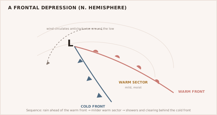
In temperate latitudes the weather is dominated by depressions tracking eastward with their warm and cold fronts, separated by ridges of high pressure. Wind blows nearly along the isobars, anticlockwise around a low in the northern hemisphere, and harder where the isobars crowd together. The Master reads the synoptic chart, the forecasts, NAVTEX, weatherfax and GRIB data, and above all the trend of the barometer, to anticipate what is coming and to route around it.
| Feature | Typical weather |
|---|---|
| Warm front approaching | Lowering cloud, continuous rain, wind backing then veering |
| Cold front passing | Squally showers, sharp veer, rising pressure, clearing |
| Tight isobars | Strong winds |
| Occlusion | The low mature; mixed cloud and rain as fronts merge |
| Reading the synoptic picture. |
Tropical and command decisions
On worldwide passages the Master must understand tropical revolving storms — their seasons, regions, and the dangerous and navigable semicircles — and the rules for recognising and avoiding one. Weather is met with command decisions: to sail or wait, to divert, to slow, to heave-to or to shelter, taken early on the trend rather than late in a rising sea. The Master weighs the forecast against the ship, the crew and the passage, and is prepared to change the plan.
WARNING — Recognise and avoid the tropical storm A falling barometer, an ominous swell, and increasing wind and cloud in the tropics can signal an approaching revolving storm. Know the rules for the dangerous and navigable semicircles and act early — these storms are avoided, not ridden out.
TIP — Command acts on the trend Weather rewards the Master who decides on the developing picture, not the one who waits for certainty. A diversion or a decision to shelter is far easier taken early than forced late.