
Pressure, wind and the global pattern
Air flows from high pressure to low pressure but is deflected by the Earth's rotation, so surface wind blows nearly along the isobars rather than straight across them, and it blows harder where the isobars are close together. On the largest scale this gives the trade winds, the variable belts, and the roaring forties. Buys Ballot's Law lets an observer find the low without a chart: in the northern hemisphere, stand with your back to the wind and low pressure is on your left (it is on your right in the southern hemisphere). Near coasts the pattern is modified by sea and land breezes and by katabatic winds draining down from high ground.
Water vapour, cloud and fog
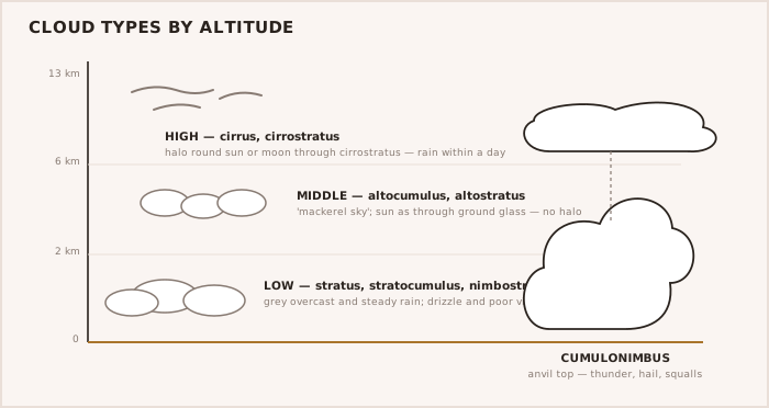
- When moist air is cooled to its dew point, the water vapour condenses into cloud or fog.
- Advection fog forms when warm, moist air moves over a colder sea; it is common, thick and persistent, and is the fog the mariner meets most.
- Radiation fog forms overnight over cooling land and can drift out over estuaries and coasts at dawn.
- Humidity is measured with a wet-and-dry-bulb hygrometer; a small difference between the readings warns that fog is likely.
Depressions and forecasting
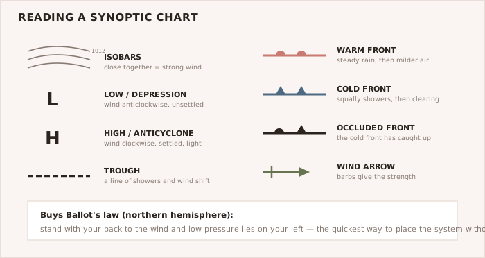
A frontal depression forms on the polar front, with a warm sector of mild moist air wedged between an advancing warm front and a following cold front, the two eventually catching up to occlude. Its passage brings a fairly predictable sequence — backing then veering wind, a falling then rising barometer, and bands of rain at the fronts. The barometer and barograph track the pressure trend, and the OOW builds the picture from the shipping and area forecasts, NAVTEX, weatherfax or GRIB data and the synoptic chart, reading it against publications such as the Mariner's Handbook (NP100).
TIP — Watch the barometer's trend, not just its value A rapidly falling glass warns of strengthening wind before the wind itself arrives. A fall of several millibars in a few hours deserves the Master's attention and an early review of the plan.