
The global picture
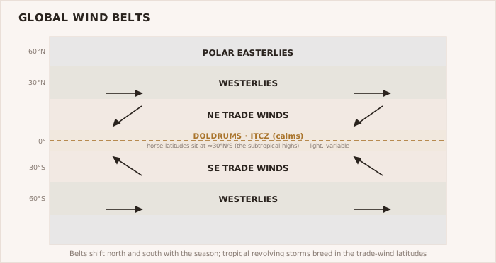
- The wind belts: the steady trade winds, the calms and squalls of the doldrums (ITCZ), the variables, and the westerlies of higher latitudes.
- Tropical revolving storms — hurricanes, cyclones, typhoons — occurring in defined regions during defined seasons, with a dangerous and a navigable semicircle.
- The great ocean currents, which help or hinder a passage and shape the sea.
- Pilot and routeing charts giving the average winds, currents and storm frequencies month by month.
Routeing by season
Ocean routeing is, above all, about being in the right ocean at the right time of year. The navigator uses the routeing charts to choose a season and a track that catch favourable trade winds and currents while keeping clear of the tropical-storm regions in their season. A tropical revolving storm has a dangerous semicircle, where the wind and the storm's motion combine and drive a vessel toward the track, and a navigable semicircle where they partly oppose; knowing the rules for recognising an approaching storm and acting early is a matter of survival.
WARNING — Plan around the storm season The first rule of ocean routeing is never to be in a tropical-storm region during its storm season. Seasonal planning, using the routeing charts, is what keeps the boat out of the worst danger the ocean holds.
NOTE — Currents shape the passage too The great ocean currents can add or subtract a knot or more over a passage and steepen the sea where they run against the wind. They are planned for alongside the winds, not as an afterthought.