
The idea behind a sight
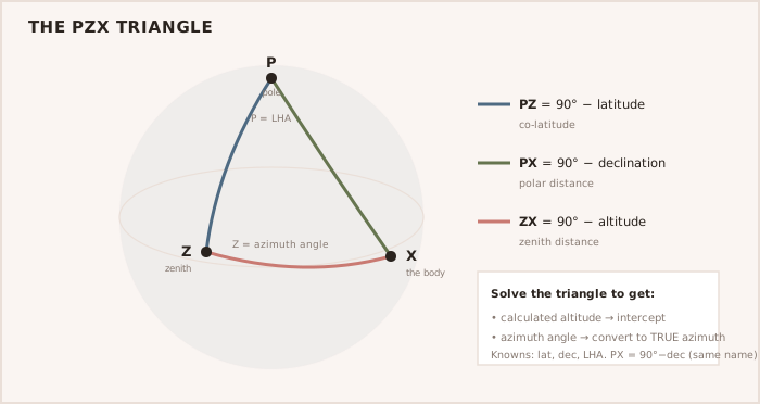
A sextant measures the altitude — the vertical angle — of a celestial body above the horizon. The principle is comparison: knowing the exact time and the body's tabulated position from the Nautical Almanac, the navigator calculates the altitude the body should have from an assumed position and compares it with the measured altitude. The difference, the intercept, together with the body's bearing (azimuth), fixes a position line at right angles to that bearing. Two or more crossed lines give a fix, exactly as with compass bearings ashore.
- Measure the sextant altitude, correcting for index error, dip, refraction and (for the sun) semi-diameter.
- Note the exact time in UTC to the second.
- From the almanac, take the body's position (its GHA and declination) for that time.
- Calculate the altitude and azimuth for the assumed position, compare to get the intercept, and lay off the position line.
NOTE — Time is everything in astro-navigation Because the Earth turns, an error of about four seconds of time misplaces a sight by roughly one nautical mile. An accurate timepiece checked against a time signal, with its error logged, is essential.
TIP — One sight is a line, not a fix A single observation only tells you the boat lies somewhere on a line. It takes two or more crossed lines, or a running fix from one body, to give an actual position.