
Entry & progression
Exam module: Q172 — Navigation Problems: Chart Plot. 10 questions, 90% pass mark. You may miss one. Examined on the near-coastal route only.
What it asks
You are given a training chart and asked to solve the small number of problems that make up practical coastal navigation:
- Plot a position from two or three bearings, or from a bearing and a distance.
- Find the course to steer to make good a desired track, given a current.
- Find the speed made good and the ETA.
- Find set and drift by comparing a DR position with a fix.
- Measure a distance and a true course between two points.
- Convert between true, magnetic and compass.
The three positions, and the difference between them
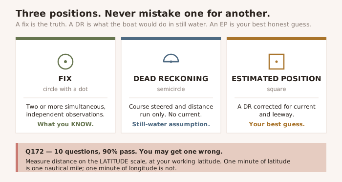
| Position | What it is | Symbol |
|---|---|---|
| Fix | A position from two or more simultaneous, independent observations. What you know. | A circle with a dot |
| Dead reckoning (DR) | A position projected from the last fix using only course steered and distance run. No current, no leeway. | A semicircle |
| Estimated position (EP) | A DR position corrected for the effects of current and leeway. Better than a DR, worse than a fix. | A square |
The distinction is examined directly, and it matters at sea. A DR is what the boat would have done in still water. An EP is your best honest guess. A fix is the truth. Never treat one as another.
Working practice that earns marks
- Label every line. A course line gets the true course above it and the speed below. A bearing line gets the time.
- Plot a DR position at every course change, every speed change, and every fix.
- Work in true on the chart. Convert to compass only at the last step, when you have a course to hand to the helm.
- Use the compass rose nearest to your work — variation is not uniform across a large chart.
- Measure distance on the latitude scale at the side, at the latitude you are working. Never on the longitude scale along the bottom.
WARNING — One minute of latitude is one nautical mile. One minute of longitude is not. Meridians converge towards the poles, so a minute of longitude shrinks as you go north or south. Only the latitude scale gives true distance, and only at the latitude you are actually working. Measuring distance off the bottom of the chart is the single most common way to fail this module.
Taking a fix
Two bearings will give you a position. Three will tell you whether to believe it. Plot three and they will rarely meet in a point — they will form a small triangle, the cocked hat. A small cocked hat means a good fix. A large one means something is wrong: a misidentified object, a compass error you have not applied, or a bearing taken too long after the others.
- Choose objects with a good angle of cut — around 60° to 90° apart. Two bearings that cut at 20° produce a long, thin, useless position.
- Take the bearing that is changing fastest last, and the slowest-changing first. Beam bearings change quickly; bearings ahead change slowly.
- Identify the object with certainty. A perfectly-taken bearing of the wrong lighthouse is worse than no bearing at all, because you will believe it.
- Where the cocked hat is large and a danger lies nearby, assume you are at the corner nearest the danger. It is the only assumption that costs you nothing if you are wrong.
Speed, time and distance
The whole module runs on D = S × T. Sixty D Street: 60 × D = S × T, with distance in nautical miles, speed in knots and time in minutes. Rearrange it whichever way the question demands. Every ETA, every speed made good and every distance-run calculation in the exam is that one formula, and candidates lose marks to arithmetic far more often than to navigation.